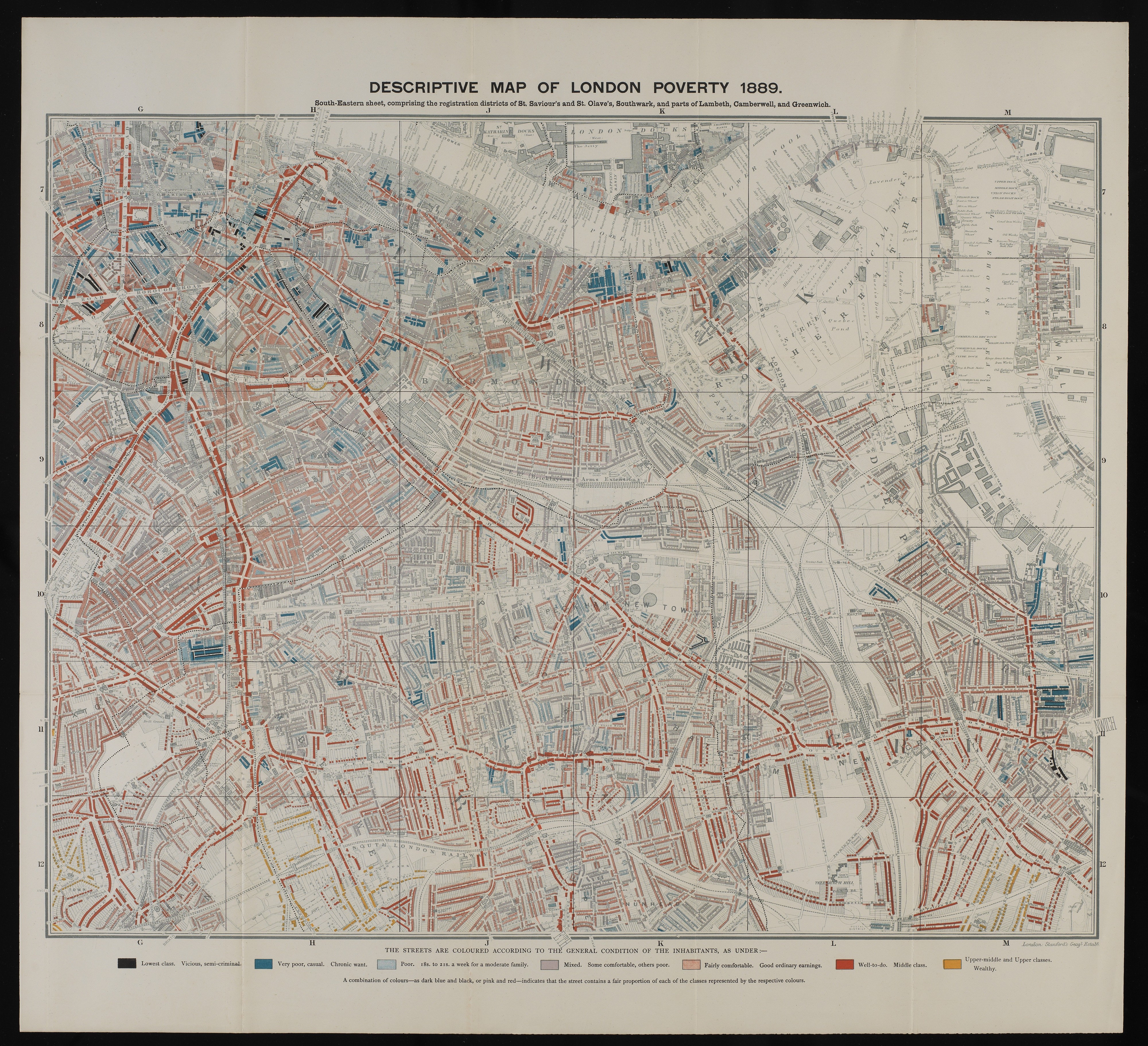
L0074437 Descriptive map of London poverty, 1889
Credit: Wellcome Library, London. Wellcome Images
[email protected]
http://wellcomeimages.org
South-Eastern sheet, comprising the registration districts of St. Saviour’s and St. Olvae’s, Southwark, and parts of Lambeth, Camberwell, and Greenwich.
Charles Booth, Life and labour in the people of London.
Life and labour of the people in London /
Charles Booth
Published: 1892-1897
Copyrighted work available under Creative Commons Attribution only licence CC BY 4.0 http://creativecommons.org/licenses/by/4.0/