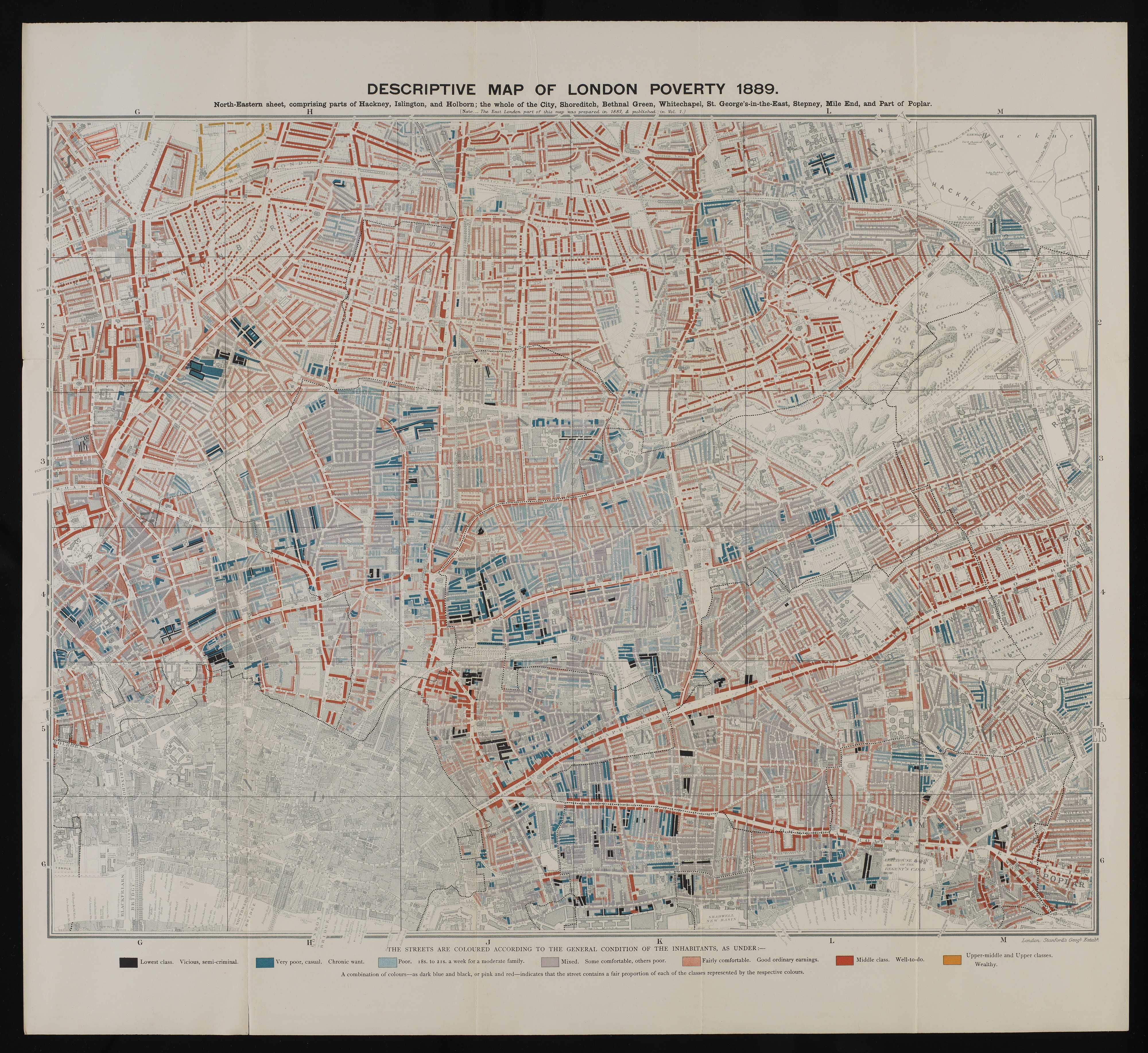
L0074439 Descriptive map of London poverty, 1889.
Credit: Wellcome Library, London. Wellcome Images
[email protected]
http://wellcomeimages.org
Descriptive map of London poverty, 1889.
North-Eastern sheet, comprising parts of Hackney, Islington, and Holborn: the whole of the City, Shoreditch, Bethnal Green, Whitechapel, St. George’s-in-the-East, Stepney, Mile End and Part of Poplar.
Charles Booth, Life and labour of the people in London.
Life and labour of the people in London /
Charles Booth
Published: 1892-1897
Copyrighted work available under Creative Commons Attribution only licence CC BY 4.0 http://creativecommons.org/licenses/by/4.0/